Masākāēw Trail Bike Route
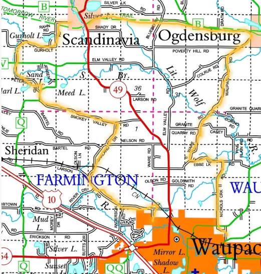
Masākāēw Trail Bike Route – 29 mile route from Waupaca to Ogdensburg on the Tomorrow River Trail to Scandinavia and back to Waupaca. – 2023

Brochure on Masākāēw Trail Bike Route – (PDF link to download)
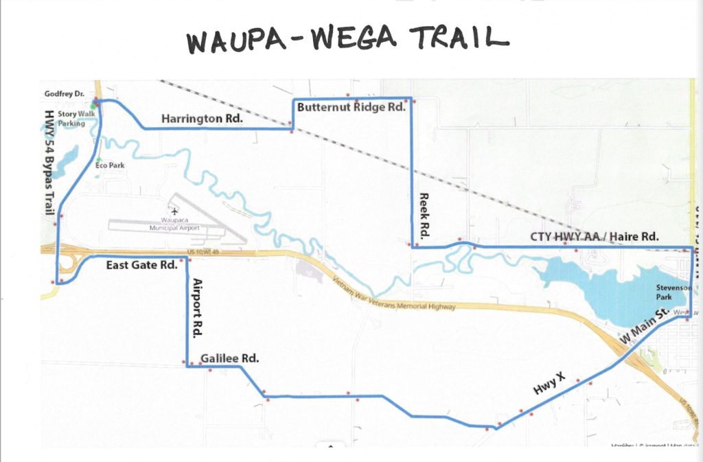
Waupa-Wega Biking/Hiking Route – 2023-2024 Project

Learn more about the Waupa-Wega trail project here
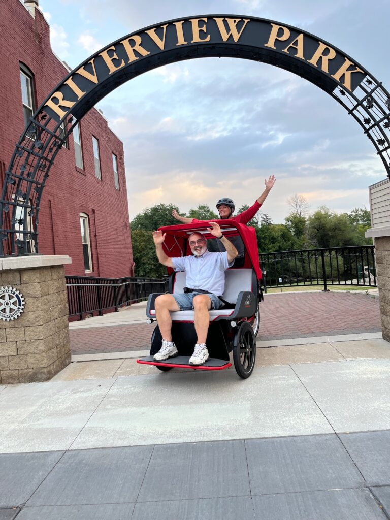
Trishaw Project

Learn more about the Trishaw project here
Upcoming Projects
Hartman Creek State Park to Waupaca – 2024-2025
Off-road trail from the Red Mill area to Waupaca High School – 2025
County Highway K is on the docket for improvements in 2025.
GWAPT has been working with the County Highway Commissioner for almost 10 years on the safety concerns we have for bikers and hikers in this area.
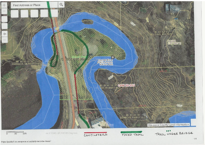
County K is regularly used by the track team at the high school and would be an excellent trail for walking or biking to the high school. The Chamber grant writer has contacted the county highway commissioner and they are in the process of writing a grant for the off road trail from the high school to the Red Mill and the revision of Nelson Park pictured below.
We currently have $11,000 which was committed by contributors to this area after the Golding Park project did not succeed. $5,000 of this was from John Gusmer, a dedicated contributor to the community who passed away recently. The rest is from donors who offered to allow GWAPT to keep the money they contributed for the park in the pot for the future. Now the future is here.
We will be fundraising for this as soon as we know if we have a grant and how much we need to raise for matching funds. This will be an expensive but very worthwhile and needed project not only for locals but also the many tourists who frequent this area.
Below is a map of the Crystal River near the Red Mill showing our proposal for an off road trail from the high school to the Red Mill. We recommend coming down County K on the side of Faith Community Church. The “bridge” there now is really a culvert. We would need a bridge to replace this with cantilevers and a rail separating the cantilevers from the roadway.

The map indicates cantilevers in red, paved trail sections in green, and a path along the Crystal River under a bridge with a dotted line. Nelson Park is a County Park and could then be accessed on foot or bicycle coming up to another cantilever on the Red Mill side where there is a very steep dropoff. Thus, no bicyclists or pedestrians would ever have to cross County K. The entrance to this park presently is very hazardous and would likely be eliminated. We would appreciate any comments on this plan in CONTACT US. These can be useful in our communication with the Highway Committee who has not yet approved this plan. We are trying to stay ahead of any engineering of the area.